Safety Tips for Mountaineering in Iran
February 26, 2024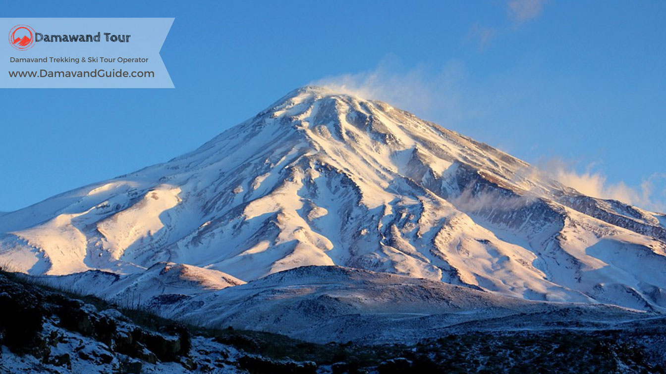
History of Mountaineering in Iran
March 1, 2024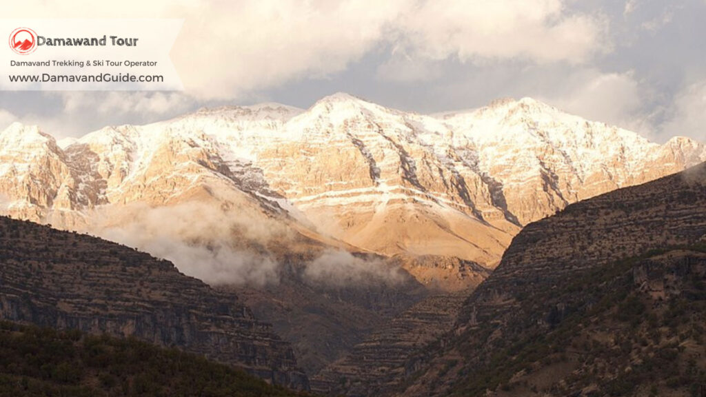
Zard Kuh | Guide to Climbing Zardkooh in Iran
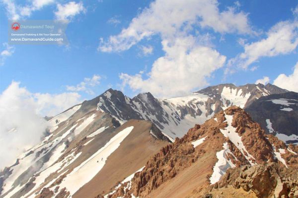
One of Iran’s best destinations for mountain climbing is the Zard kuh mountain range, known as Zardkuh Bakhtiari, located in the Chaharmahal and Bakhtiari provinces. Zard Kuh is considered the second highest range in the Zagros mountains in Iran after the Dena mountain. This mountain range, with an approximate length of 123 kilometers and an average width of 20 kilometers, starts from the Shahr-e Kord area and ends at the Kaj village in the Koohrang area. The highest peak of Zardkuh, called Kolunchin, stands at 4225 meters.
Where is Zard Kuh?
Zardkuh is located in the central Zagros region and Chaharmahal and Bakhtiari province in Iran. After the Dena mountain range, it is considered the second-highest region in the Zagros. The Zardkuh mountain range lies between the Koohrang river and the Bazoft river.
The orientation of the Zard Kuh range stretches from northwest to southeast, which aligns with the general formation of the Zagros. This cluster of peaks is located at the westernmost end of the Chaharmahal and Bakhtiari province.
Geographical Location of Zardkuh Bakhtiari
The Zardkuh Bakhtiari mountain ranges (or Zardeh) are situated between the two large rivers, Koohrang and Bazoft, in Chaharmahal and Bakhtiari province. The direction of this range from northwest to southeast follows the general movement of the Zagros structure. This mountain range is one of the richest natural water reserves in Iran, with some of the main sources of the Karun river, Iran’s largest river, and some of the main sources of the Zayandeh-rud originating from this range.
This range, with a width of about 15 kilometers, includes high peaks above 4000 meters such as Kino, Haft-Tanan, Shah-Shahidan, Zardeh, Cheri, Kolunchin, and others. Among these, the peak of Kolunchin, standing at 4221 meters, is the highest peak of Zardkuh Bakhtiari.
Kolunchin peak is accessible from the northeast via a ridge to Shah Shahidan peak, Dozardeh peak, and Haft Tanan peak, and from the southwest to Cheri peak and Kuh-e Mili. A roughly 200-meter cliff is located on the northern face of Kolunchin, and the peak can be accessed from the south via a trail.
Shelters and Refuges of Zardkooh
The Chal Mishan shelter and the Khersan shelter have been built on the eastern slopes of this peak. The Chal Mishan shelter is made of metal, and the Khersan shelter is made of stone with a metal roof. There is water available near the Chal Mishan shelter.
Kool Khodang in Zardkuh
A gorge known as Kool Khodang, locally named, and officially called Tang-e Kolunchin, is one of the routes for ascending to Kolunchin peak. Kool Khodang is located above the exit of the second water transfer tunnel from the Karun river headwaters to the Zayandeh-rud. This tunnel brings water from a place called Marboreh down to Kool Khodang, where it is accumulated behind a dam and then directed into the intake of a hydroelectric power plant, and after exiting the power plant, it flows towards the Zayandeh-rud.
Peaks of ZardKuh in Iran
The Zardkooh mountains in Iran have many peaks. Interestingly, a precise count of the peaks in this area hasn’t been made yet, and some of them are not even named on geographical maps. Based on available information, it’s estimated that there are about 20 peaks in Zardkooh over 4,000 meters high. Some of the peaks in Zardkooh include:
- – Shah Shahidan: Mentioned as being between 4,150 meters and 4,076 meters in different sources.
- Zardeh
- Nazi: 4,075 meters.
- Chal Tav: 4,075 meters.
- Tapa: 4,053 meters.
- Shadneg: 4,011 meters.
- Dodeng: 4,009 meters.
- Sirdan: 3,988 meters.
- Ghanbarkesh: 3,970 meters.
- Pelle Boland: 3,947 meters.
- Chal Mishan: 3,897 meters.
- Ilook: 3,837 meters.
- Ab Sefid: 3,759 meters.
- Do Zardeh: 4,000 meters.
- Haft Tanan: Mentioned as being between 4,109 meters and 4,170 meters in different sources.
- Darvish Kozli: 4,078 meters.
- Koloonchi or Koloonchin: 4,225 meters.
- Chagaleh: 4,136 meters.
- Cheri
- Kino
Climbing to Kolunchin in Zardkuh
The usual path to climb this mountain is through Chelgard city. 4 kilometers before Chelgard, there is a sign for the facilities and Tunnel Number 2 of Koohrang on the road to Shahr-e Kord. This road, which is 15 kilometers long and unpaved, ends at a bridge. After crossing the bridge, a trail leads to the beginning of the Kol Khadang valley. The starting point of the trail is approximately 2,450 meters high according to sources. Inside the valley, you can sometimes see stone walls along the path. Also, there is a spring in this valley.
The valley starts steeply and gradually becomes less steep. It leads to an area in the north of the Zardkuh mountain range peaks. Here, you can see three peaks: Dozardeh, Shah Shahidan, and Kolunchi. Continuing on the trail, you will circle the main peak of Kolunchi and after reaching the Shah Shahidan peak pass, you will arrive at the main peak of Kolunchi.
Specification of the Zardkuh Bakhtiari Region
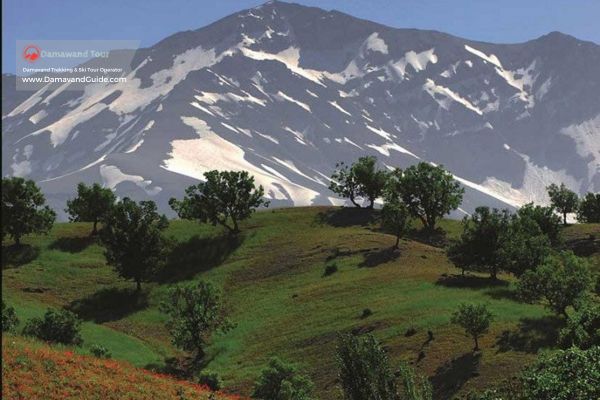
Important specifications of the Zardkooh area include the Il Big and Poursounan glaciers, Khadang and Khersan valleys (Kul), Nazli Lake, and the single-tree summer pastures of Bazoft. The glaciers and ridgelines of Zardkuh are beautiful, worth seeing, and yet dangerous. Zardkuh has very cold nights and scorching sunny days.
The Zagros mountain range is located in the west and south of Iran, starting from the shores of Lake Van in Turkish Kurdistan and extending through the provinces of Azerbaijan, Kurdistan, Kermanshah, Isfahan, Chaharmahal and Bakhtiari, Khuzestan, and Lorestan to the provinces of Fars and Kerman.
The Bakhtiari Zardkooh is located in the central Zagros. Gahar Lake is also in the Zagros mountains, which is one of the most unique areas for the growth of various medicinal plants and unique in the world. The upside-down tulips of Koohrang are also rare in the world.
Naming of Zagros Range
Some believe the name Zagros is of Avestan origin. In the Avestan language, Za-GR means “great mountain,” and some say Zagros is the Greek name for the mountain range in western Iran, especially Bakhtiari in western Iran. Others have said that Zagros is a mountain range in Asia that stretches from northwest to southeast, separating Media from Assyria.
Another group considers Zagros the name of the Sagartian tribe, one of the significant Iranian tribes, and says that the nomads of the Median tribe were called Sagartians.
Diakonoff in his book on the history of Media mentions the Assyrian attack on Pasavada and their penetration into Median territory, reaching the last point of their campaign at a strong Median fortress named Sagartia Zakroati, praising their resistance and bravery.
The Bakhtiari People in Iran
The Bakhtiari people comprise two large tribes called Haft Lang and Chahar Lang. The inhabitants of Chelgerd are from the Babadi clan, and the residents of Birgan and Ab Barik are from the Behdarvand clan. Both of these clans are part of Haft Lang. The population of the Bakhtiari people in the country is estimated to be around 3 million.
The Bakhtiari tribe has been one of the most powerful and influential tribes in the fate of Iran’s government in the not-so-distant past and are known as defenders of Iran’s day of doom.
The land of the Bakhtiari has nurtured great children including Cyrus the Great, Ariobarzan, Mana, Kian, Kay Qobad, Kay Khusraw, Khurzad (the lady of Anzan), Siavashan, Arian, Sardar Asad Bakhtiari, the conqueror of Tehran during the Constitutional Revolution, leaders of the cavalry that conquered Kandahar and India during Nader Shah Afshar’s era, Dr. Mohsen Rezaee, the secretary of the Expediency Discernment Council and commander of the 8-year Defense Sacred, the only presidential candidate with a plan in 2009, Dr. Ghasem Aminpour, Hossein Pezhman Bakhtiari, a pioneer poet, Darab Officer Bakhtiari, a stylistic poet, Sardar Maryam Bakhtiari, Kaveh the Blacksmith, and thousands of other unknowns.
For decades and centuries, without any ethnic prejudice, every Iranian around the world is proud of them, and on the other hand, it has been a safe haven for other ethnicities and notable individuals such as Dr. Dehkhoda, Dr. Mosaddegh, and thousands of others during their exile and misfortune.
Before the Pahlavi era when Iran was governed in a feudal manner, the border of Bakhtiari land, which included parts of Isfahan province, Chaharmahal and Bakhtiari province, Khuzestan province, and part of Lorestan province, had never been moved for more than three thousand years.
During Alexander’s invasion of Iran, which led to the fall of the whole of Iran due to the betrayal of some Iranians, Alexander’s army could never gain control over the central part of Bakhtiari.
Even during the early Islamic Arab invasion of Iran and the complete fall of Iran, the Arabs could not gain control over the central part of Bakhtiari. The Bakhtiaris accepted Islam about 376 years after Islam because the governance of the Islamic government was based on the administrative system of the Sassanians, and they became entirely Twelver Shiites.
The official clothing of Bakhtiari women and men does not have a front and back or left and right.
The Chogha, which is the men’s overcoat, is inspired by the structure of Chogha Zanbil, the first ancient Iranian site registered with UNESCO.
The inversion of this pattern was formed after Alexander’s attack on Persepolis in memory of the fallen guards of Persepolis led by Ariobarzan. Also, the pattern formed on the women’s Lachak with beads goes back to the sacred elements of ancient Iran.
The Bakhtiari and Qashqai tribes are the only Iranian tribes still practising nomadism.
The history and culture of the Bakhtiari tribe are vast and cannot be fully covered in this article, not even to mention its headlines.
The first oil well in Iran was drilled in Bakhtiari land with the participation of the Bakhtiari Oil Company and Britain.
45 to 50% of Iran’s surface and groundwater reserves are from the Zagros mountains.
Rivers of Zardkooh
The sources of the Zayandeh-Rud, Karun, Karkheh, and Dez rivers are from the Zagros mountains. The most significant and important dams and power plants are in Bakhtiari land.
The Zardkuh Bakhtiari mountain range is located in southwestern Iran, stretching from the westernmost part of Chaharmahal and Bakhtiari province to the east and northeast of Khuzestan.
This mountain range is one of Iran’s richest natural water reserves, and two of the country’s most water-abundant rivers (Karun and Zayandeh-Rud) also originate from its slopes.
The Karun River is the most water-abundant and largest river in Iran. It is the longest river that is entirely located within Iran, with a length of 950 kilometers, and it is also the only navigable river in Iran. The drinking water of the metropolis of Ahvaz is supplied from the Karun River.
The Zayandeh-Rud is the most important central river in Iran, originating from the always snow-capped 3,000 to 4,000-meter peaks of Zardkuh Bakhtiari and
Koohrang in Chaharmahal and Bakhtiari province. After a winding course, it enters Isfahan province from the west. The name of the Zayandeh-Rud river is always intertwined with the name of the city of Isfahan, in such a way that wherever Isfahan is mentioned, everyone recognizes this beautiful city by its famous river.